hiking

Race Report: 4 Peaks

As regular visitor to the Victorian Alps each year, I had heard about the 4 peaks trail running event andhad been planning to do it for many years especially knowing it is an iconic with a great community feel trail running and hiking event in Australia, starting in 1979.

In the lead up to the event there was many reports about changed race courses due to logging and snow in the Vic Alps which unfortunately this was the case, but safety is of the highest priority.

The 4 peaks alpine climb event takes place over the Melbourne Cup long weekend, with a different peak to ascend/ descend each day with official distances ranging from 10km-15km each day.

Day 1 – Mystic Hill

Distance - 10km - 929m gain/descent

As informed in the lead up the Mystic Hill course was changed due logging of the local forest which almost double the original course elevation for the day. Mystic Hill is situated and overlooks the beautiful town of Bright.

The run was held in perfect sunny and mild conditions and followed mostly fire trails and unfortunately i tweaked my left calf on the first major descent when i lost footing underneath me. It was very tender for the rest of the run so decided to only run short section of the flats and hike the climbs.

Mystic Hill, Bright, Victoria

As I found out the hard way some of the steep fire trails were very dangerous in perfect conditions like on the day we had and imagine it would be treacherous and possibly scary on a wet day!

The Mystic Hill course is the only day with start to finish in the same location of the 4 day trail running event.

Day 2 – Mt Feathertop

Distance - 10km - 1164m gain

The course for day 2’s ascent up to Mt Feathertop summit was shortened by 2km due to too much snow at the peak. The finish was revised to finish at Federation Hut. Mt Feathertop summit is the 2nd highest peak in the Victoria Alps at 1922 metres elevation.

The race started at Tavare Park in Harrietville and followed the Bungalow Spur walking track and is a continuous gradual climb to finish line at Federation hut. There was an eerie feeling as the fog and weather closed in around us as we hiked through the snow gums. It could have been a scene out of the film, Sleepy Hollow.

Mt Feathertop, Victoria

As we arrived at the finish line it started to rain and visibility was poor. I heard about 10 minutes later the sky cleared and you could see view of Mt Feathertop Summit under snow.

A good thing to note about this day is there is no transport access (at federation hut or usual finish at Mt Feathertop summit) to finish area so be prepared you need to descend back to the start, adding an extra 10km (or 12km) for the day!

Day 3 – Mt Hotham

Distance - 15km - 1288m elevation gain

The expected forecast for day was possible snow shower with a minimum -7 degrees celsius to maximum of 2 degrees.

The race started at Tavare Park in Harrietville and followed the Bon Accord Spur track with a river crossing at Washington creek challenging as the bridge had been washed away by flooding. However, the race organisers kindly arranged for rope to assist with crossing the river.

Wellington River Crossing, Mt Hotham, Victoria

It was very tough and slow going climbing up the wall on the Bon Accord Spur especially in the last 2km with a 450m + elevation gain to reach the Razorback and finish at Dimmatina hut. The view and experience of running in the snow was breathtaking. It was unbelievable experience to see the snow especially at the end of October. The snow was very soft almost fluffy like in your hand.

Mt Hotham under snow

The bus even experienced the tough conditions as it couldnt make it up to the finishing area to pick up the race participants, so after finishing we needed to descent 1km down the road to meet the bus but we were fortunately greeted by a heated tent with hot tea, fresh fruit and fruit cake which hit the spot!

It was minus 4 degrees when we finished.

Day 4 -Mt Buffalo

Distance - 10km -  1014m elevation gain

The forth and final day started at Eurobin Creek picnic ground at the base of Mt Buffalo. The trail goes straight up with a steep first 2kms along the track known as ‘The Big Walk’.

Mt Buffalo, Victoria

It then becomes a more gradual climb up to the start of the granite rocks which Mt buffalo is famous for, just after waving to my sister who I could see on the road below I had a nasty fall on the wet and slippery moss rock face and landed heavily on my hand, elbow and hip. It especially hurt my elbow which took most of the weight of my fall. I had to cradle my arm for the next few mins as I recovered, adrenaline was definitely pumping now.

Aftermath of my fall on Mt Buffalo

I took it easy for the next section especially some more slippery rocks ahead. I felt much better as I cleared the rock section and started to reach the plateau and circumnavigate the top of Mt Buffalo around the famous chalet (which is unfortunately no longer open) and you climb the stairs and finish right in front of chalet. Sidenote - I remember enjoying hot chocolates in the chalet as a teenager after doing this hike many years ago in torrential rain.

The 4 Peaks was a well organised and fun trail running or hiking event, a great way to enjoy Melbourne Cup long weekend. I definitely plan on coming back to run this event again the future.


Related Reading

Race Report - Ultra Trail Australia 100km ultramarathon, Blue Mountains

Race Report - The Harvest Run, Healesville

Hiking On The Trail – Mt Macedon

I decided to take advantage of our recent Cup Day public holiday to explore the trails around Mt Macedon. It’s pretty amazing we get a public holiday for a horse race!
It has been quite a while since I had been out to Mt Macedon, so was good to get out of the city and explore this beautiful area again. It’s under an hours’ drive from Melbourne’s CBD.
We started outside the local Mt Macedon pub and headed up to the Macedon Ranges Walking Track via Douglas Road.
The hike started off well with my mate dropping and shattering his drink bottle, despite it been plastic bottle, think it might have been due to the ice cold water!
The walking trail starts after a short but steep section of road, and then you continue up along steep single track towards Memorial Cross at the top. It is a great spot to stop and enjoy the views plus admire the local gum tree forest and short walk further on to the Major Mitchell lookout also provides a great vantage point to see the local landscape.
We continued past the local tea rooms, which also provide you another great spot to relax and enjoy the surrounds.
We continued along the trail through Camerons Picnic Ground and around the Camels Hump. The Camels Hump is a popular rock climbing spot in the Macedon Ranges. We spent a few minutes watching the rock climbers traverse up along the rocks. We then returned to the track and continue around Days Picnic Ground which we decided was a good spot for lunch. It was a popular spot, with many families taking advantage of the public holiday to enjoy a nice day out with a family barbecue.
A short stroll from Days Picnic Ground is the Eco Tourism Trail which leads to Sanatorium Lake. The lake was built to supply water to the local Sanatorium which was set up to care for patients with tuberculosis in the early 1900’s. The Eco-Tourism Trail offers beautiful high eucalypt forests and a wet fern gully.
Once going past the lake we continue on to the Sanatorium Lake Picnic Ground and down towards Barringo Road and then onto the beginning of Zig Zag Track. The Zig Zag Track winds its way down through local forest to Hemphills Track andwe turned off the Hemphills Track and carried on along Mount Towrong Track towards the peak. As you come out from the treeline of Mount Towrong, you get a great view of the local township of Mount Macedon and beyond. There is a steep section of track as you descend towards Anzac Road and back into Mount Macedon.

This was a great 17km loop along the Macedon Ranges Walking Trail, with the Macedon Regional Park offering around 30kms of walking track to explore the local attractions it’s a great spot to get out of the city for a day trip. It is also popular trail running spot with Macedon being the location local Mountain trail run series each year around May, with 10km, 30km and 50km ultramarathon available.


Hiking on the Trail: The Grampians

With the recent announcement of a new state based public holiday, I thought this was the perfect opportunity to head away for a long weekend hiking trip.

I decided I wanted to explore a place I had not visited for a while and with the recent opening of the first section of the Grampians Peaks Trail. I thought why not! The first section is a 36.6km loop around Lake Bellfield and taking popular viewing spots of The Pinnacle and Mt Rosea. The Grampians National Park is situated about 3 hours drive north west of Melbourne.

I packed my hike pack and headed up to the Grampians on Thursday night with my sister, staying in one of the local caravan parks that night. 
On Friday morning we were up early as we had about 5-6 hrs of hiking ahead of us and with a perfect weather forecast of 25-29 degrees celsius scheduled for the weekend, it was going to be warm hiking on the trails. We logged our hike itinerary at the local cultural centre and then we were off!

Ready to Go!

Ready to Go!

On Day 1 we started in the town centre of Halls Gap and headed off towards Borough Huts, the first section was along a sealed walking track out of town and then onto Terraces Fireline track, after the initial sealed track the first few kilometres was quite undulating. We decided to have our lunch break beside Lake Bellfield where we looked straight across towards Mt Rosea, where we would be heading tomorrow! We continued along the firetrails down to Borough Huts campsite. This was a beautiful, spacious campsite situated beside a creek. We set up camp and then headed down to the creek. The creek was the place to be, with kids and parents alike enjoying the water. We decided to tip our feet in, the cool water was perfect remedy after 14km of hiking! We enjoyed an early dinner and a few games of UNO then it was off for an early nights’ sleep. 

On day 2 we were up early again with challenging day ahead planned for us which involved climbing Mt Rosea. We began through sheltered forest on single track as we began the 8.5km ascent up to the peak of Mt Rosea. After the initial kilometre or so of reasonably flat terrain the trail continued to head up and we kindly greeted by a kangaroo on the path, it stared intently at us for a minute or two then bounded off into the bushes. 

The trail became increasingly challenging as we came closer to Mt Rosea which involved several kilometres of rock scrambling and rock hopping, which was challenging with hike pack on your back!

We finally made it to the top of Mt Rosea after our 700m+ ascent from Borough Huts. The views were amazing and well worth it despite the windy conditions, which led to my sister’s hat being blown of the cliff’s edge. We enjoyed an early lunch and took in the views!

View from Mt Rosea

View from Mt Rosea

It was now time for the fun part of rock scrambling downhill, we took it slow and steady and chatted to quite a few hikers heading up Mt Rosea from the other direction. We continued along the ridge across the sandy track and down into Messmate forest past Rosea car park and travelled the remaining few hundred metres into Bugiga hiker campsite. The Bugiga campsite was quite unique with 12 purpose built camp platforms for hikers to camp their tents upon.

Bugiga Campsite

Bugiga Campsite

We didn’t enjoy a very good nights’ sleep due to quite windy conditions also losing an hour’s sleep due to daylight savings commencing overnight, we were up at 6.30am (5.30am pre daylight savings time).

Lakeview Lookout

Lakeview Lookout

Day 3 began with an ascent towards the ridge line as we headed over to Lakeview Lookout. The lookout provided stunning views of Lake Bellfield and beyond! It was great to remember we were on the other side of the lake only a day and a half ago. After Lakeview Lookout we continued our ascend up to the famous Pinnacle Lookout. It provided a spectacular view across the Grampians National Park. 

Panoramic View from The Pinnacle

Panoramic View from The Pinnacle

We continued our rock scrambling down the other side of the Pinnacle down through Silent Street and past many day hikers as they headed up to The Pinnacle. It was great to see many family groups enjoying the perfect hiking weather.  We continued our descent towards the Wonderland car park and planned to go through the Grand Canyon, but unfortunately this section was closed to track renovations, we went past the car park and followed the path to Splitter Falls and enjoyed the undulations as travelled beside Stony Creek and down to the Venus Baths. The baths were a very popular spot for the nice Spring day we had. We enjoyed the leisurely stroll back into Halls Gap which included going through the local Botanic Gardens.

The only downer for the trip came as we arrived back to the car to find we had a flat tyre, other than that it was a great long weekend.

I thoroughly enjoyed following the Grampians Peaks Trail in reverse to the suggested loop, despite the 8.5km ascent up to Mt Rosea on the 2nd day, I found the 2nd and 3rd days’ scenery and views to be thoroughly more enjoyable compared to the first day along the fire trails and this only happened due campsites being fully booked at Bugiga for the planned first night, so we decided to follow the loop in reverse.

I look forward to heading back to explore more sections of the Grampians Peaks Trail as it continues to be constructed to form the 144km (13 day/12 night) walk across the Grampians National Park, which is due to be completed in 2017.

See you on the trail!

Related Reading

Hiking on the trail: Wilson’s Promontory

Hiking on the trail: Wilson’s Promontory

I recently had the opportunity to go back to Wilson’s Prom, affectionately known as The Prom. The last time I visited the Prom was many years ago when I was a teenager on a family holiday.

The Prom is one of Victoria’s most-loved destinations. Wilson’s Prom is situated at the southernmost tip of mainland Australia; it offers mesmerising scenery of vast granite mountains, forests, endless beaches and coastlines.

After a catch up with a couple of mates and my sister we decided we would undertake East Prom Coastal overnight hike.

An early start on a chilling Autumn Saturday morning and it was drizzling rain on our drive to Wilsons Promontory but it started to clear as we arrived at Tidal River.

Once we arrived at Tidal River we caught the courtesy bus to Telegraph Saddle Car Park where we commenced our hike mid-morning. The first part is a steady climb to Windy Saddle where we saw the restoration of some sections which had been washed away from previous flash flooding in 2011 and then we headed downhill through a scenic landscape and across the boardwalk over Sealers Swamp and arriving at Sealers Cove. It is important to check the tide times so you avoid a deep water crossing here, fortunately we arrived just after low tide so was an easy crossing! We stopped here at Sealers Cove for a short lunch break.

Sealers Cove

Sealers Cove

View back towards Sealers Cove

View back towards Sealers Cove

Then heading up along the ridge and enjoyed many stunning views as we continued our walk to Refuge Cove.

Refuse Cove, Wilsons Promontory

Refuse Cove, Wilsons Promontory

The next section was the most challenging of our hike where we encountered a steep rocky 2km+ climb to Kersops Peak, but we are rewarded with spectacular views. Our pace slowed in the last 4kms as we travelled along the coastline to our camp at Little Waterloo Bay. It was a long but very rewarding day of hiking 23.6km for the day.

Beach near Little Waterloo Bay Wilsons Promontory

Beach near Little Waterloo Bay Wilsons Promontory

The next morning we walked along the beach and then headed inland across the sand dunes back to the Telegraph Track before heading back to Telegraph Saddle Car Park. The circuit is 35.5km in total.

There are so many day and overnight hiking possibilities at Wilsons Promontory, and I would highly recommend it as it is one of the most spectacular places to enjoy nature’s beauty in Australia.

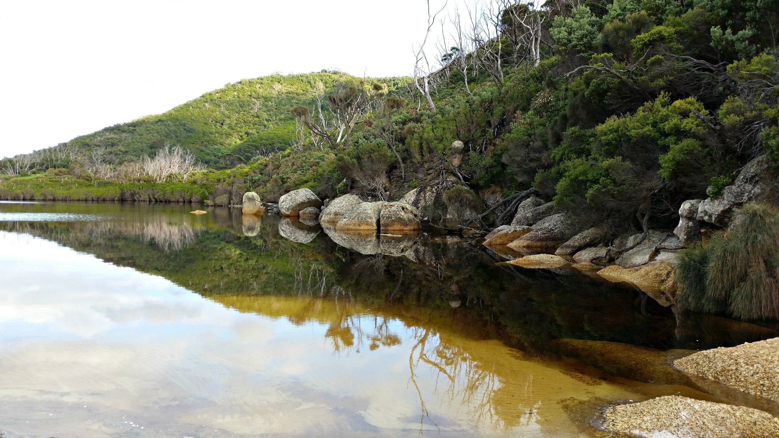
Lagoon at Wilsons Promontory

Lagoon at Wilsons Promontory

For more information about hiking at The Prom click here